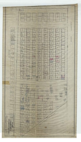
Plan of Cemetery Portion of Block 5
https://search.bvmuseum.org/link/descriptions7267
- Date Range
- [1974]
- Collection
- Town of Smithers fonds
- Description Level
- Item
- GMD
- cartographic material
- Collection
- Town of Smithers fonds
- Description Level
- Item
- Creator
- Village of Smithers
- Fonds No.
- GF4
- Series No.
- S1
- Item No.
- 2017.41.27
- Accession No.
- 2017.41
- Physical Description
- 1 map
- Scan Resolution
- 600 dpi
- Date Range
- [1974]
- Arrangement
- Scale: 1" = 10'
- Geographic Access
- Smithers, B.C.
- Notes
- While information on map states "Surveys made Dec 29 1922 / August 1924", the map contains reference to a burial from 1974 (Katherine E. Chapman), and so information dates to at least 1974.
- Type of Record
- Archival Description
